The world of global shipping is a complex and dynamic system that plays a crucial role in international trade. Understanding shipping routes is essential for businesses, researchers, and policymakers alike. This article delves into the significance of global shipping routes, the utility of shapefiles in mapping these routes, and the various applications of this data in different sectors.
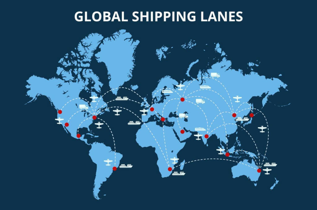
Table of Contents
The Importance of Global Shipping Routes
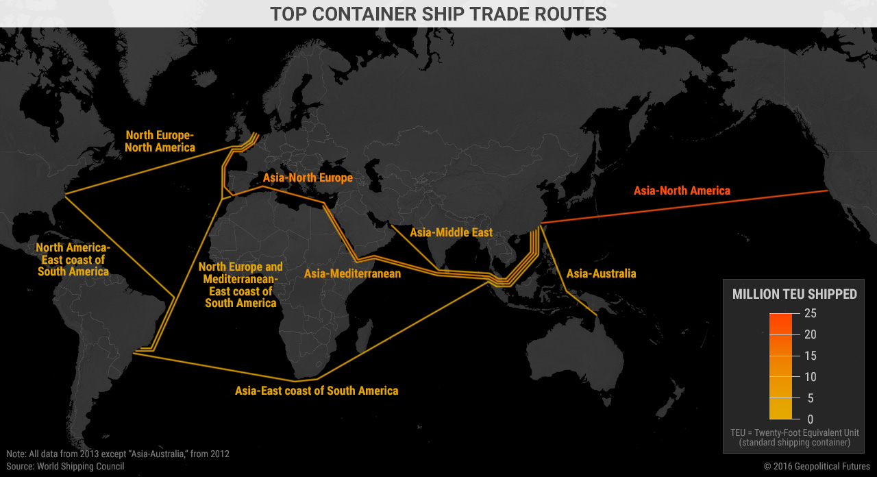
Global shipping routes are the pathways that vessels take to transport goods across oceans and seas. These routes are not only vital for the movement of goods but also for the economic stability of nations. The following sections will explore the factors influencing these routes and their implications.
Economic Impact of Shipping Routes
Shipping routes are the backbone of global trade. Approximately 90% of the world’s goods are transported by sea, making shipping routes critical for economic growth. The efficiency of these routes can significantly affect shipping costs, delivery times, and ultimately, the prices consumers pay for goods.
The economic impact of shipping routes extends beyond mere transportation costs. Efficient shipping routes can lead to reduced fuel consumption, lower emissions, and improved delivery times, all of which contribute to a more competitive market. For instance, companies that can optimize their shipping routes can offer lower prices to consumers, thereby increasing their market share.
Environmental Considerations
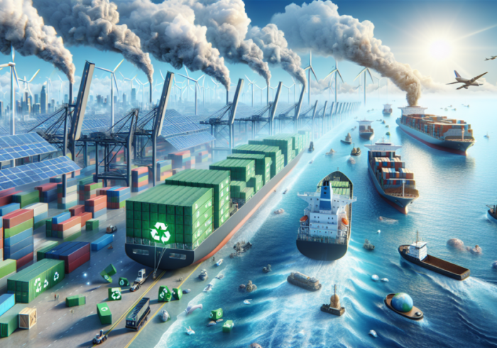
While shipping routes facilitate trade, they also pose environmental challenges. The shipping industry is a significant contributor to greenhouse gas emissions. Understanding shipping routes through shapefiles can help in identifying areas where emissions can be reduced and where alternative, more sustainable routes can be developed.
The environmental impact of shipping is multifaceted. It includes not only carbon emissions but also the potential for oil spills, marine pollution, and the disruption of marine ecosystems. By analyzing shipping routes, researchers can identify high-risk areas and develop strategies to mitigate these impacts. For example, rerouting ships away from sensitive marine habitats can help protect biodiversity.
Geopolitical Factors
Shipping routes are often influenced by geopolitical factors. Tensions between countries can lead to changes in shipping lanes, affecting global trade dynamics. For instance, the Strait of Hormuz is a critical chokepoint for oil shipments, and any instability in this region can have far-reaching consequences for global oil prices.
Geopolitical events can also lead to the imposition of sanctions or trade restrictions, which can alter established shipping routes. Companies must remain agile and responsive to these changes to maintain their supply chains. The ability to quickly adapt to new shipping routes can be a significant competitive advantage in the global market.
Understanding Shapefiles
Shapefiles are a popular geospatial vector data format used in geographic information system (GIS) software. They allow for the representation of geographic features and their attributes. In the context of global shipping routes, shapefiles can provide detailed information about shipping lanes, ports, and maritime boundaries.
Components of Shapefiles
A shapefile consists of several files that work together to represent geographic data. The main components include:
- .shp: Contains the geometry data.
- .shx: Contains the shape index data.
- .dbf: Contains attribute data for the shapes.
These components work together to provide a comprehensive view of geographic features, making shapefiles an invaluable tool for mapping shipping routes. The ability to visualize shipping routes in a GIS environment allows for better analysis and decision-making.
How Shapefiles Are Created
Creating shapefiles involves collecting data from various sources, including satellite imagery, maritime databases, and navigational charts. This data is then processed and formatted into shapefiles, which can be used in GIS applications to visualize and analyze shipping routes.
The process of creating shapefiles typically involves several steps:
- Data Collection: Gathering data from reliable sources such as the International Maritime Organization (IMO), national maritime authorities, and satellite tracking systems.
- Data Processing: Cleaning and organizing the data to ensure accuracy and consistency.
- Shapefile Creation: Using GIS software to convert the processed data into shapefiles, which can then be used for mapping and analysis.
Software Tools for Shapefile Analysis
Several software tools are commonly used to analyze and visualize global shipping route shapefiles. These include:
- ArcGIS: A powerful GIS software that allows users to create, analyze, and visualize geographic data, including shipping routes.
- QGIS: An open-source alternative to ArcGIS, QGIS provides similar functionalities for analyzing shapefiles and is widely used in academia and industry.
- Google Earth: While not a traditional GIS tool, Google Earth allows users to visualize geographic data in a user-friendly interface, making it accessible for a broader audience.
Applications of Global Shipping Route Shapefiles
The applications of global shipping route shapefiles are vast and varied. They can be utilized in several fields, including logistics, environmental science, and urban planning.
Logistics and Supply Chain Management
In logistics, understanding shipping routes is crucial for optimizing supply chains. Companies can use shapefiles to analyze shipping lanes, identify the most efficient routes, and reduce transportation costs. This data can also help in planning for contingencies, such as rerouting due to weather conditions or geopolitical issues.
The integration of shapefiles into logistics management systems allows companies to visualize their supply chains in real-time. This capability enables businesses to make informed decisions quickly, such as adjusting shipping routes based on current conditions or predicting potential delays.
Environmental Monitoring
Shapefiles can be used to monitor the environmental impact of shipping. By analyzing shipping routes, researchers can identify areas of high emissions and develop strategies to mitigate their impact. This is particularly important in the context of international agreements aimed at reducing greenhouse gas emissions from shipping.
Environmental monitoring using shapefiles can also extend to tracking marine biodiversity and the health of ecosystems affected by shipping activities. By overlaying shipping routes with ecological data, researchers can identify critical habitats and develop conservation strategies.
Urban Planning and Development
Urban planners can use shipping route data to inform infrastructure development. For instance, understanding shipping traffic can help in the planning of port facilities, road networks, and public transportation systems. This ensures that urban areas are equipped to handle the demands of global trade.
In addition, shipping route data can inform zoning decisions and land use planning. By understanding the flow of goods, planners can make more informed decisions about where to locate warehouses, distribution centers, and other logistics facilities.
Maritime Safety and Security
Shapefiles are also essential for enhancing maritime safety and security. By mapping shipping routes, authorities can identify high-risk areas for piracy, smuggling, or other illegal activities. This information can be used to allocate resources effectively and improve maritime security measures.
Furthermore, shapefiles can assist in search and rescue operations by providing detailed information about shipping lanes and vessel movements. In the event of an emergency, having access to accurate shipping route data can significantly improve response times and outcomes.
Challenges in Mapping Shipping Routes
Despite the advantages of using shapefiles to map shipping routes, several challenges exist. These include data accuracy, the dynamic nature of shipping routes, and the need for real-time data.
Data Accuracy
The accuracy of shapefiles depends on the quality of the data collected. Inaccurate data can lead to misrepresentations of shipping routes, which can have significant implications for businesses and policymakers. Ensuring data accuracy requires continuous monitoring and updates.
To improve data accuracy, organizations can implement robust data validation processes. This may involve cross-referencing data from multiple sources and using advanced algorithms to detect anomalies.
Dynamic Nature of Shipping Routes
Shipping routes are not static; they can change due to various factors, including weather conditions, geopolitical tensions, and economic shifts. This dynamic nature makes it challenging to maintain up-to-date shapefiles that accurately reflect current shipping routes.
To address this challenge, organizations can invest in real-time tracking technologies, such as Automatic Identification Systems (AIS), which provide continuous updates on vessel movements. Integrating this real-time data into shapefiles can enhance their accuracy and utility.
Need for Real-Time Data
In today’s fast-paced world, the need for real-time data is more critical than ever. Businesses require up-to-date information on shipping routes to make informed decisions. Integrating real-time data into shapefiles can enhance their utility but also adds complexity to the data management process.
Organizations can leverage cloud-based solutions to facilitate real-time data integration. By using cloud platforms, businesses can access and analyze shipping route data from anywhere, enabling more agile decision-making.
Future Trends in Global Shipping Routes
As technology continues to evolve, several trends are likely to shape the future of global shipping routes and their mapping.
Automation and Digitalization
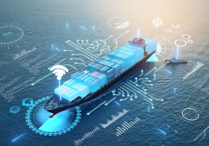
The shipping industry is increasingly adopting automation and digitalization. Technologies such as autonomous vessels and advanced logistics software are transforming how goods are transported. Shapefiles will play a crucial role in this transformation by providing the necessary data for optimizing automated shipping routes.
Sustainability Initiatives
With growing concerns about climate change, the shipping industry is under pressure to adopt more sustainable practices. This includes exploring alternative fuels, optimizing shipping routes to reduce emissions, and implementing stricter environmental regulations. Shapefiles will be essential in tracking and analyzing the environmental impact of these initiatives.
Enhanced Data Analytics
The future of shipping route analysis will be driven by enhanced data analytics capabilities. Machine learning and artificial intelligence will enable more sophisticated analyses of shipping routes, allowing for better predictions and optimizations. Shapefiles will serve as a foundational data source for these advanced analytics.
Increased Collaboration
As global trade becomes more interconnected, collaboration among stakeholders will be essential. This includes partnerships between shipping companies, governments, and environmental organizations. Shapefiles can facilitate this collaboration by providing a common framework for sharing and analyzing shipping route data.
Conclusion
Global shipping routes are essential for international trade, and understanding them through shapefiles can provide valuable insights for various sectors. While challenges exist in mapping these routes, the benefits of using shapefiles for analysis and decision-making are significant. As the shipping industry continues to evolve, the importance of accurate and up-to-date shipping route data will only increase.
In summary, global shipping routes and their representation through shapefiles are crucial for optimizing logistics, monitoring environmental impacts, and informing urban planning. As technology advances, the ability to analyze and visualize these routes will become even more sophisticated, paving the way for more efficient and sustainable global trade practices.
As you explore the intricate world of global shipping routes and their impact on trade, consider enhancing your logistics and supply chain efficiency with innovative solutions. Discover more at LooperBuy.
Article Summary: This article explores the significance of global shipping routes and the role of shapefiles in mapping these routes. It discusses the economic, environmental, and geopolitical factors influencing shipping routes, the components and creation of shapefiles, and their applications in logistics, environmental monitoring, and urban planning. The article also addresses the challenges of data accuracy, the dynamic nature of shipping routes, and the need for real-time data. Additionally, it highlights future trends in the shipping industry, including automation, sustainability initiatives, enhanced data analytics, and increased collaboration.
Hot Tags: Global Shipping Routes; Shapefile; Maritime Trade; GIS; Environmental Impact; Logistics; Supply Chain Management; Urban Planning; Geopolitical Factors; Shipping Lane Optimization; Data Accuracy; Real-Time Data; Shipping Industry; International Trade; Port Facilities; Emission Monitoring; Satellite Imagery; Geographic Information System; Transportation Costs; Infrastructure Development; Maritime Boundaries; Shipping Traffic; Contingency Planning; Economic Growth; Greenhouse Gas Emissions; Data Management; Shipping Database; Navigational Charts; Trade Dynamics; Shipping Costs
Related Questions & Answers
· What are the primary data sources for creating global shipping route shapefiles?
The primary data sources include satellite imagery, maritime databases, navigational charts, and data from organizations like the International Maritime Organization (IMO).
· How do geopolitical events influence the creation and maintenance of global shipping route shapefiles?
Geopolitical events can lead to changes in shipping lanes, sanctions, or trade restrictions, necessitating updates to shapefiles to reflect new routes and conditions.
· What software tools are commonly used to analyze and visualize global shipping route shapefiles?
Common tools include ArcGIS, QGIS, and Google Earth, which allow users to create, analyze, and visualize geographic data related to shipping routes.